
Fichye:Kingdom of England.png
Dimansyon previzyalizasyon sa a : 586 × 599 piksèl. Lòt rezolisyon yo: 235 × 240 piksèl | 470 × 480 piksèl | 751 × 768 piksèl | 1 218 × 1 245 piksèl.
Fichye orijinal (1 218 × 1 245 piksèl, gwosè fichye a : 20 kio, tip MIME li ye : image/png)
| Deskripsyon |
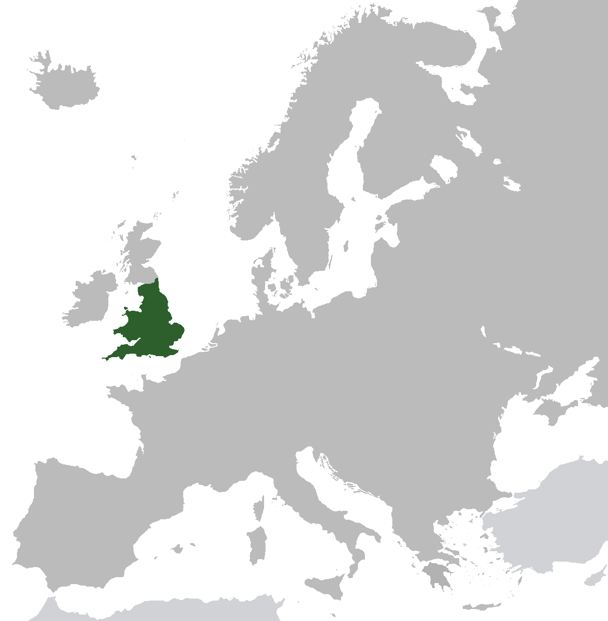
English: Map of the Kingdom of England from ca. 1282 to 1603. Does not include islands attached to the crown, but not incorporated into England, or varying territories in France. |
| Dat | |
| Sous | Travay pèsonèl (Original text: I created this work entirely by myself.) |
| Kreyatè | Gav235 (talk) |
Kondisyon itlizasyon
| Cette œuvre a été placée dans le domaine public par son auteur, Gav235 sur Wikipedya anglais. Ceci s’applique dans le monde entier. Dans certains pays, ceci peut ne pas être possible ; dans ce cas : Gav235 accorde à toute personne le droit d’utiliser cette œuvre dans n’importe quel but, sans aucune condition, sauf celles requises par la loi. |
Journal des téléversements d’origine
Transferred from en.wikipedia to Commons by Broadbeer using CommonsHelper.
The original description page was here. All following user names refer to en.wikipedia.
- 2009-07-12 17:25 Gav235 1218×1245× (62805 bytes) {{Information |Description = Map of the Kingdom of England |Source = I created this work entirely by myself. |Date = 12 July 2009 |Author = ~~~ |other_versions = }}
Istorik fichye a
Klike sou yon dat/yon lè pou wè fichye a jan li te ye nan moman sa a.
| Dat ak lè | Minyati | Grandè yo | Itilizatè | Komantè | |
|---|---|---|---|---|---|
| Kounye a | 10 novanm 2014 à 06:35 | | 1 218 × 1 245 (20 kio) | AnonMoos | increasing PNG compression |
| 20 fevriye 2014 à 12:20 |  | 1 218 × 1 245 (132 kio) | Rob984 | Non-European regions light grey | |
| 23 septanm 2012 à 07:16 |  | 1 218 × 1 245 (39 kio) | TRAJAN 117 | Standardise colours, minor fixes. | |
| 12 desanm 2010 à 21:38 |  | 1 218 × 1 245 (39 kio) | VEO15 | Isle of Man + Danish border | |
| 6 avril 2010 à 12:48 |  | 1 218 × 1 245 (39 kio) | Hayden120 | Corrected Cyprus. | |
| 26 oktòb 2009 à 20:13 |  | 1 218 × 1 245 (61 kio) | File Upload Bot (Magnus Manske) | {{BotMoveToCommons|en.wikipedia|year={{subst:CURRENTYEAR}}|month={{subst:CURRENTMONTHNAME}}|day={{subst:CURRENTDAY}}}} {{Information |Description={{en|Map of the Kingdom of England}} |Source=Transferred from [http://en.wikipedia.org en.wikipedia]; transf |
Itilizasyon fichye sa a
paj sa a itilize fichye sa a:
Itilizasyon global fichye a
Wiki sa a yo sèvi ak fichye sa a:
- Itilizasyon sou af.wikipedia.org
- Itilizasyon sou als.wikipedia.org
- Itilizasyon sou ar.wikipedia.org
- Itilizasyon sou arz.wikipedia.org
- Itilizasyon sou ast.wikipedia.org
- Itilizasyon sou azb.wikipedia.org
- Itilizasyon sou az.wikipedia.org
- Itilizasyon sou be.wikipedia.org
- Itilizasyon sou bg.wikipedia.org
- Itilizasyon sou ca.wikipedia.org
- Itilizasyon sou da.wikipedia.org
- Itilizasyon sou de.wikipedia.org
- Itilizasyon sou el.wikipedia.org
- Itilizasyon sou en.wikipedia.org
- Itilizasyon sou eo.wikipedia.org
- Itilizasyon sou et.wikipedia.org
- Itilizasyon sou eu.wikipedia.org
- Itilizasyon sou fr.wikipedia.org
- Itilizasyon sou ga.wikipedia.org
- Itilizasyon sou gl.wikipedia.org
- Itilizasyon sou gv.wikipedia.org
- Itilizasyon sou hr.wikipedia.org
- Itilizasyon sou it.wikipedia.org
- Itilizasyon sou kk.wikipedia.org
- Itilizasyon sou mk.wikipedia.org
- Itilizasyon sou nl.wikipedia.org
- Itilizasyon sou pnb.wikipedia.org
- Itilizasyon sou pt.wikipedia.org
- Itilizasyon sou ro.wikipedia.org
- Itilizasyon sou ru.wikipedia.org
- Itilizasyon sou sco.wikipedia.org
- Itilizasyon sou sh.wikipedia.org
- Itilizasyon sou sr.wikipedia.org
- Itilizasyon sou sv.wikipedia.org
- Itilizasyon sou ta.wikipedia.org
- Itilizasyon sou tg.wikipedia.org
- Itilizasyon sou tr.wikipedia.org
- Itilizasyon sou www.wikidata.org
- Itilizasyon sou yo.wikipedia.org