
Fichye:Territorios de la Segunda República Española-variante.svg

Taille de cet aperçu PNG pour ce fichier SVG : 396 × 600 piksèl. Lòt rezolisyon yo: 158 × 240 piksèl | 317 × 480 piksèl | 507 × 768 piksèl | 676 × 1 024 piksèl | 1 352 × 2 048 piksèl | 4 950 × 7 500 piksèl.
Fichye orijinal (Fichye SVG, rezolisyon de 4 950 × 7 500 piksèl, gwosè fichye : 1,73 Mio)
Rezime
| Deskripsyon |
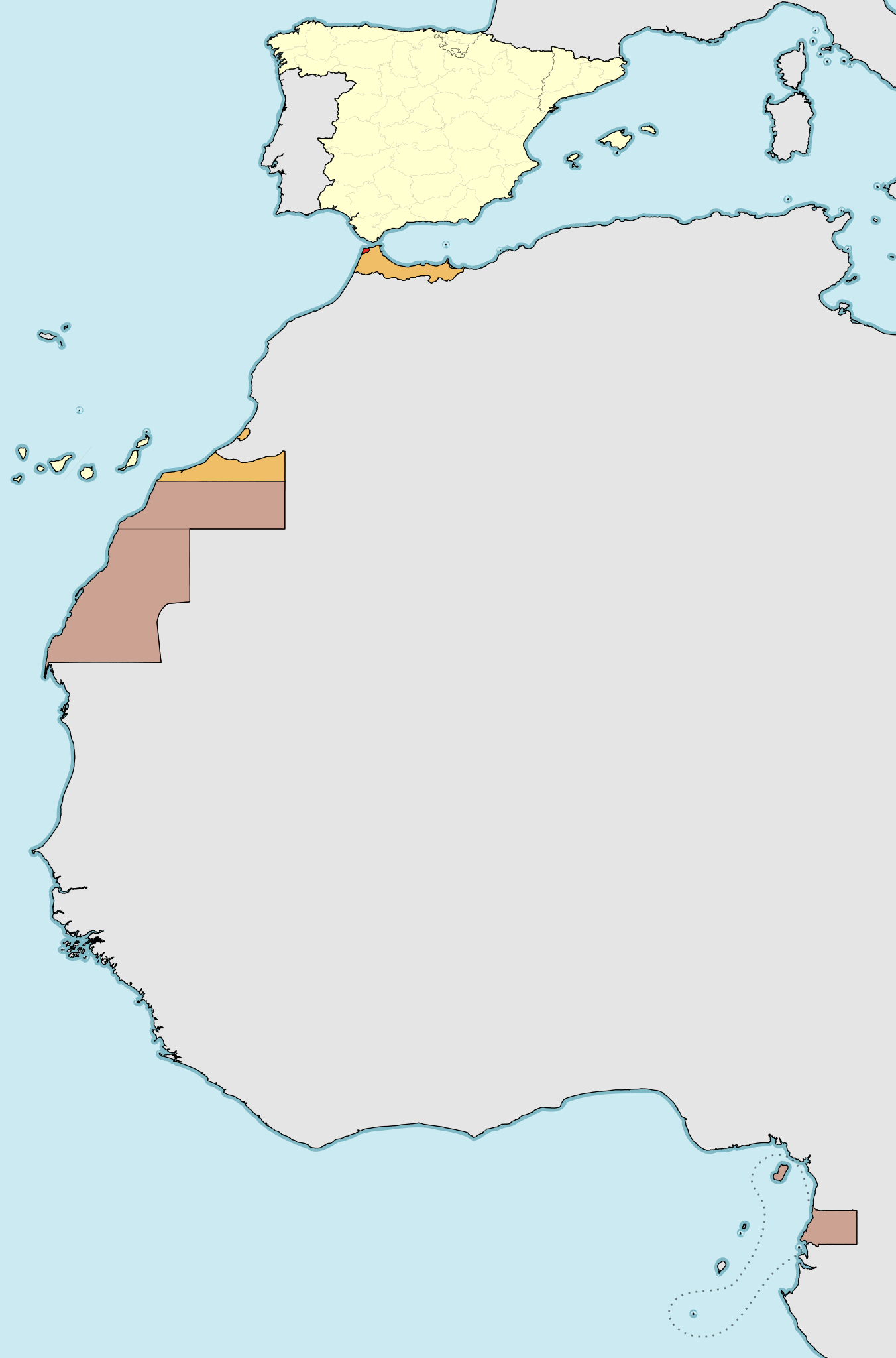
Deutsch: Die Zweite Spanische Republik mit Überseebesitzungen in Afrika:
Spanisches Kernland Protektorat Spanisch-Marokko Spanisch-Sahara und Spanisch-Guinea Internationale Zone von Tanger English: Map of the territories and colonies under the Second Spanish Republic government (1931-1936/39).
Spain, mainland and islands International Zone of Tangiers. Español: Mapa de los territorios bajo soberanía de la Segunda República Española (1931-1936/39).
España (territorio peninsular, Baleares, Canarias, Ceuta, Melilla y plazas de soberanía), con las regiones autónomas de Cataluña y País Vasco señalado y administración provincial (Diputaciones provinciales o forales) Protectorado español de Marruecos (norte de Marruecos, Ifni y Cabo Juby) Colonia de Sahara Español (Territorios de Saguia el-Hamra y Río de Oro), Colonia de Guinea Española (Territorios Españoles del Golfo de Guinea: Guinea continental o Río Muni, islas de Fernando Poo, Elobey, Annobón y Corisco (antigua Colonia de Elobey, Annobón y Corisco) Zona Internacional de Tánger |
| Dat | (UTC) |
| Sous |
Ce fichier est dérivé de : Territorios de la Segunda República Española.svg:  |
| Kreyatè |
|
| Cette image a été retouchée, ce qui signifie qu'elle a été modifiée par ordinateur et est différente de l'image d'origine. Liste des modifications : different color scheme. L'image d'origine se trouve ici : Territorios de la Segunda República Española.svg:
|
Kondisyon itlizasyon
Moi, en tant que détenteur des droits d’auteur sur cette œuvre, je la publie sous les licences suivantes :
Ce fichier est sous licence Creative Commons Attribution – Partage dans les Mêmes Conditions 3.0 (non transposée), 2.5 Générique, 2.0 Générique et 1.0 Générique.
- Ou gen dwa:
- pou pataje – pou kopye, distribiye epi difize ouvraj la
- pou remiks – pou adapte ouvraj la
- Selon kondisyon sa a yo:
- Rekonèt avèk non otè – Ou dwe bay enfòmasyon apwopriye sou otè a, bay yon lyen pou lisans lan, epi endike si te gen chanjman ki fèt. Ou ka fè sa nan nenpòt fason rezonab, men okenn fason ki sijere ke otè a soutni oswa apwouve itilizasyon ou an.
- Enfòmasyon sa yo ka pataje – Si ou fè rekopye, transfòme, oswa baze sou materyèl sa, ou dwe distribye kontribisyon ou anba menm oswa yon lisans konpatib avèk orijinal la.

|
Ou bay pèmisyon pou kopye, distribye ak/oswa modifye dokiman sa a dapre kondisyon GNU Free Documentation License, Vèsyon. 1.2 oswa nenpòt vèsyon ki pibliye pita pa Free Software Foundation; san okenn Seksyon ki pa ka chanje, pa gen okenn Tèks ak premye paj kouvèti, epi pa gen okenn Tèks Denyè-Kouvèti. Gen yon kopi lisans lan nan seksyon ki rele GNU Free Documentation License. |
Chwazi lisans ou vle a.
Journal des téléversements d’origine
This image is a derivative work of the following images:
- File:Territorios_de_la_Segunda_República_Española.svg licensed with Cc-by-sa-3.0,2.5,2.0,1.0, GFDL
- 2010-11-15T16:47:54Z Ras67 4950x7500 (1012236 Bytes) this is the right one
- 2010-11-15T16:44:39Z Ras67 2000x3030 (1012599 Bytes) repaired
- 2010-11-15T00:43:56Z Larry Yuma 4950x7500 (1793136 Bytes) -frameborder
- 2009-06-15T15:29:28Z HansenBCN 4950x7500 (1791372 Bytes) ajuste grosores
- 2009-06-15T15:20:21Z HansenBCN 4950x7500 (1789838 Bytes) coloración; añadidas las fronteras administrativas provinciales
- 2009-06-15T12:32:50Z HansenBCN 512x776 (915395 Bytes) correccion de bordes y transparencia
- 2009-06-15T12:30:37Z HansenBCN 512x776 (915328 Bytes) {{Information |Description={{en|1=Map of the territories under goverment of the Second Spanish Republic (1931-1936/39)}} {{es|1=Mapa de los territorios bajo soberanía de la Segunda República Española (1931-1936/39) Rojo:
Téléversé avec derivativeFX
}}
Istorik fichye a
Klike sou yon dat/yon lè pou wè fichye a jan li te ye nan moman sa a.
| Dat ak lè | Minyati | Grandè yo | Itilizatè | Komantè | |
|---|---|---|---|---|---|
| Kounye a | 26 avril 2013 à 12:22 | | 4 950 × 7 500 (1,73 Mio) | Furfur | == {{int:filedesc}} == {{Information |Description={{de|1=Die Zweite Spanische Republik mit Überseebesitzungen in Afrika:{{legend|#FFFFCC|Spanisches Kernland}}{{legend|#EFBE67|Protektorat Spanisch-Marokko}}{{legend|#CCA293|Spanisch-Sahara und Spanisch-... |
Itilizasyon fichye sa a
paj sa a itilize fichye sa a:
Itilizasyon global fichye a
Wiki sa a yo sèvi ak fichye sa a:
- Itilizasyon sou azb.wikipedia.org
- Itilizasyon sou de.wikipedia.org
- Itilizasyon sou fr.wikipedia.org
- Itilizasyon sou uk.wikipedia.org