
Fichye:Mount Pleasant Historic Site.jpg
Dimansyon previzyalizasyon sa a : 800 × 402 piksèl. Lòt rezolisyon yo: 320 × 161 piksèl | 640 × 322 piksèl | 1 024 × 515 piksèl | 1 280 × 644 piksèl | 2 060 × 1 036 piksèl.
Fichye orijinal (2 060 × 1 036 piksèl, gwosè fichye a : 416 kio, tip MIME li ye : image/jpeg)
|
Ceci est une photographie d’un monument référencé dans le National Register of Historic Places des États-Unis sous le numéro 74001536. |
Rezime
| Deskripsyon |
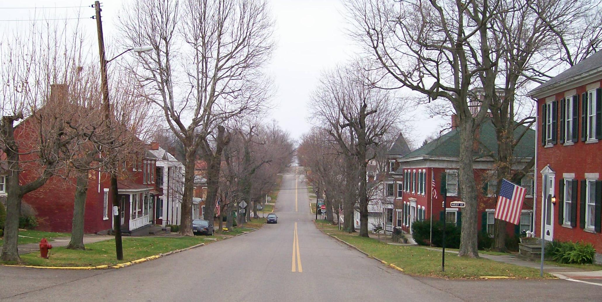
English: The Mount Pleasant Historic District in Ohio looking east along Union Street from its junction with Market Street. The district was added to the National Register of Historic Places in 1974 for national significance in the abolitionist movement including being a stop on the Underground Railroad and intact architectural integrity. Taken on 2009-11-21. |
| Dat | (UTC) |
| Sous |
I (Bwsmith84 (talk)) created this work entirely by myself. Transferred from en.wikipedia |
| Kreyatè | Bwsmith84 (talk) |
| Pèmisyon : (Resèvi ak fichye sa a) |
Bwsmith84 at en.wikipedia, en tant que détenteur des droits d’auteur sur cette œuvre, la publie sous la licence suivante : Ce fichier est disponible selon les termes de la licence Creative Commons Attribution 3.0 Non transposée. Rekonèt avèk non otè: Bwsmith84 at en.wikipedia
|
| Position de l'objet | | Voir cet endroit et d’autres images sur : OpenStreetMap |
|---|
Journal des téléversements d’origine
The original description page was here. All following user names refer to en.wikipedia.
- 2009-11-21 22:33 Bwsmith84 2060×1036 (425814 bytes) {{Information |Description = The Mount Plesant Historic Site looking from Market Street to the east. |Source = I (~~~) created this work entirely by myself. |Date = ~~~~~ |Author = ~~~ |other_versions = }}
Istorik fichye a
Klike sou yon dat/yon lè pou wè fichye a jan li te ye nan moman sa a.
| Dat ak lè | Minyati | Grandè yo | Itilizatè | Komantè | |
|---|---|---|---|---|---|
| Kounye a | 9 janvye 2012 à 09:42 | | 2 060 × 1 036 (416 kio) | BotMultichillT | {{BotMoveToCommons|en.wikipedia|year={{subst:CURRENTYEAR}}|month={{subst:CURRENTMONTHNAME}}|day={{subst:CURRENTDAY}}}} == {{int:filedesc}} == {{Information |description={{en|1=The Mount Pleasant Historic District in Ohio looking east along Union Street f |
Itilizasyon fichye sa a
paj sa a itilize fichye sa a:
Itilizasyon global fichye a
Wiki sa a yo sèvi ak fichye sa a:
- Itilizasyon sou ar.wikipedia.org
- Itilizasyon sou ca.wikipedia.org
- Itilizasyon sou ceb.wikipedia.org
- Itilizasyon sou cy.wikipedia.org
- Itilizasyon sou en.wikipedia.org
- Itilizasyon sou es.wikipedia.org
- Itilizasyon sou eu.wikipedia.org
- Itilizasyon sou fr.wikipedia.org
- Itilizasyon sou it.wikipedia.org
- Itilizasyon sou lld.wikipedia.org
- Itilizasyon sou pl.wikipedia.org
- Itilizasyon sou pt.wikipedia.org
- Itilizasyon sou sh.wikipedia.org
- Itilizasyon sou sr.wikipedia.org
- Itilizasyon sou uk.wikipedia.org
- Itilizasyon sou vi.wikipedia.org
- Itilizasyon sou www.wikidata.org
- Itilizasyon sou zh-min-nan.wikipedia.org