Aller au contenu

Fichye:Ceara MesoMicroMunicip.svg

Le contenu de la page n’est pas pris en charge dans d’autres langues.
Depi Wikipedya, ansiklopedi lib

Fichye orijinal (Fichye SVG, rezolisyon de 829 × 990 piksèl, gwosè fichye : 388 kio)

Fichye sa a sòti nan Wikimedia Commons e ka sèvi nan lòt pwojè. Desktripsyon ki sou paj li file description page ekri anba a.

  Standardization of derivative maps

Feel free to create derivations of this work, but if you want to illustrate a Wikipedia article with derivative works of this or similar maps of Brazil, please strictly follow the visual standard, nomenclature and classification already in use. All maps of Brazilian subdivisions are being adaptated or created in this way. We do not want to inhibit creativity but the pattern adopted here was presented and accepted by the Lusophone community and should be followed whenever possible.

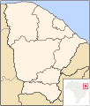
Deskripsyon Map of Ceará state
Dat
Sous Travay pèsonèl
Kreyatè Raphael Lorenzeto de Abreu
Pèmisyon :
(Resèvi ak fichye sa a)
Moi, en tant que détenteur des droits d’auteur sur cette œuvre, je la publie sous les licences suivantes :
GNU head Ou bay pèmisyon pou kopye, distribye ak/oswa modifye dokiman sa a dapre kondisyon GNU Free Documentation License, Vèsyon. 1.2 oswa nenpòt vèsyon ki pibliye pita pa Free Software Foundation; san okenn Seksyon ki pa ka chanje, pa gen okenn Tèks ak premye paj kouvèti, epi pa gen okenn Tèks Denyè-Kouvèti. Gen yon kopi lisans lan nan seksyon ki rele GNU Free Documentation License.
w:fr:Creative Commons
Rekonèt avèk non otè Enfòmasyon sa yo ka pataje
Fichye sa a distribiye selon lisans Creative Commons.
Ou gen dwa:
  • pou pataje – pou kopye, distribiye epi difize ouvraj la
  • pou remiks – pou adapte ouvraj la
Selon kondisyon sa a yo:
  • Rekonèt avèk non otè – Ou dwe bay enfòmasyon apwopriye sou otè a, bay yon lyen pou lisans lan, epi endike si te gen chanjman ki fèt. Ou ka fè sa nan nenpòt fason rezonab, men okenn fason ki sijere ke otè a soutni oswa apwouve itilizasyon ou an.
  • Enfòmasyon sa yo ka pataje – Si ou fè rekopye, transfòme, oswa baze sou materyèl sa, ou dwe distribye kontribisyon ou anba menm oswa yon lisans konpatib avèk orijinal la.
Ce bandeau de licence a été ajouté à ce fichier dans le cadre de la procédure de mise à jour des licences des images sous GFDL.
w:fr:Creative Commons
Rekonèt avèk non otè
Ce fichier est disponible selon les termes de la licence Creative Commons Attribution 2.5 Générique.
Ou gen dwa:
  • pou pataje – pou kopye, distribiye epi difize ouvraj la
  • pou remiks – pou adapte ouvraj la
Selon kondisyon sa a yo:
  • Rekonèt avèk non otè – Ou dwe bay enfòmasyon apwopriye sou otè a, bay yon lyen pou lisans lan, epi endike si te gen chanjman ki fèt. Ou ka fè sa nan nenpòt fason rezonab, men okenn fason ki sijere ke otè a soutni oswa apwouve itilizasyon ou an.
Chwazi lisans ou vle a.
Autres versions Derivative works of this file:  Brazil Ceara location map.svg

Légendes

Ajoutez en une ligne la description de ce que représente ce fichier

Éléments décrits dans ce fichier

penn

type MIME français

image/svg+xml

1d5f5b5f193f020f5895a065a411949b2d320f78

397 055 octet

990 pixel

829 pixel

Istorik fichye a

Klike sou yon dat/yon lè pou wè fichye a jan li te ye nan moman sa a.

Dat ak lèMinyatiGrandè yoItilizatèKomantè
Kounye a11 out 2011 à 23:45Minyati pou vèsyon 11 out 2011 à 23:45829 × 990 (388 kio)MarquinhosStandardization with other versions of maps that are loaded by Raphael Lorenzeto de Abreu.
29 avril 2006 à 09:55Minyati pou vèsyon 29 avril 2006 à 09:55581 × 684 (361 kio)Raphael.lorenzeto{{Information| |Description=Map of Ceará state |Source=own work |Date=April, 29 2006 |Author=Raphael Lorenzeto de Abreu |Permission={{self2|GFDL|cc-by-2.5}} |other_versions= }} Category:Maps of Ceará

Pa gen okenn paj ki itilize dosye sa a.

Itilizasyon global fichye a