
Fichye:Troy from 4500 feet.jpg
Dimansyon previzyalizasyon sa a : 800 × 600 piksèl. Lòt rezolisyon yo: 320 × 240 piksèl | 640 × 480 piksèl | 1 024 × 768 piksèl | 1 280 × 960 piksèl | 2 272 × 1 704 piksèl.
Fichye orijinal (2 272 × 1 704 piksèl, gwosè fichye a : 1,67 Mio, tip MIME li ye : image/jpeg)
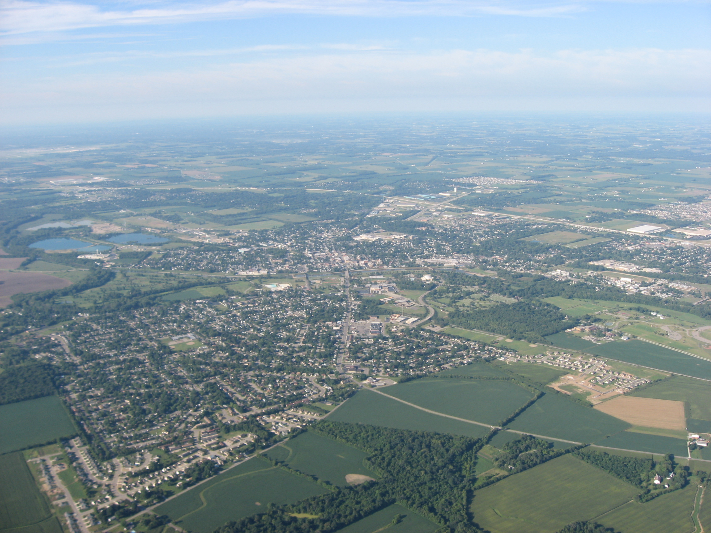
| Deskripsyon | Aerial view of Troy, a city in Miami County, Ohio, United States. The Great Miami River is partially visible in the center of the picture, dividing the city into eastern and western halves. Picture taken from a Diamond Eclipse light airplane at an altitude of 4,500 feet MSL and a bearing of approximately 215º. | ||
| Dat | Prise le 12 out 2008 | ||
| Sous | Travay pèsonèl | ||
| Kreyatè | Nyttend | ||
| Pèmisyon : (Resèvi ak fichye sa a) |
|
Istorik fichye a
Klike sou yon dat/yon lè pou wè fichye a jan li te ye nan moman sa a.
| Dat ak lè | Minyati | Grandè yo | Itilizatè | Komantè | |
|---|---|---|---|---|---|
| Kounye a | 19 septanm 2008 à 01:03 | | 2 272 × 1 704 (1,67 Mio) | Nyttend | {{Information |Description=Aerial view of {{w|Troy, Ohio|Troy}}, a city in {{w|Miami County, Ohio|Miami County}}, {{w|Ohio}}, {{w|United States}}. The {{w|Great Miami River}} is partially visible in the center of the picture, dividing the city into easte |
Itilizasyon fichye sa a
Pa gen okenn paj ki itilize dosye sa a.
Itilizasyon global fichye a
Wiki sa a yo sèvi ak fichye sa a:
- Itilizasyon sou azb.wikipedia.org
- Itilizasyon sou ceb.wikipedia.org
- Itilizasyon sou de.wikipedia.org
- Itilizasyon sou en.wikipedia.org
- Itilizasyon sou es.wikipedia.org
- Itilizasyon sou eu.wikipedia.org
- Itilizasyon sou fa.wikipedia.org
- Itilizasyon sou it.wikipedia.org
- Itilizasyon sou ja.wikipedia.org
- Itilizasyon sou ko.wikipedia.org
- Itilizasyon sou pl.wikipedia.org
- Itilizasyon sou pt.wikipedia.org
- Itilizasyon sou sh.wikipedia.org
- Itilizasyon sou sr.wikipedia.org
- Itilizasyon sou tr.wikipedia.org
- Itilizasyon sou uk.wikipedia.org
- Itilizasyon sou ur.wikipedia.org
- Itilizasyon sou uz.wikipedia.org
- Itilizasyon sou vi.wikipedia.org
- Itilizasyon sou www.wikidata.org
- Itilizasyon sou zh-min-nan.wikipedia.org
- Itilizasyon sou zh.wikipedia.org