
Fichye:Saint George Alaska aerial view.jpg
Dimansyon previzyalizasyon sa a : 800 × 531 piksèl. Lòt rezolisyon yo: 320 × 212 piksèl | 640 × 425 piksèl | 1 024 × 680 piksèl | 1 500 × 996 piksèl.
Fichye orijinal (1 500 × 996 piksèl, gwosè fichye a : 419 kio, tip MIME li ye : image/jpeg)
| Deskripsyon |
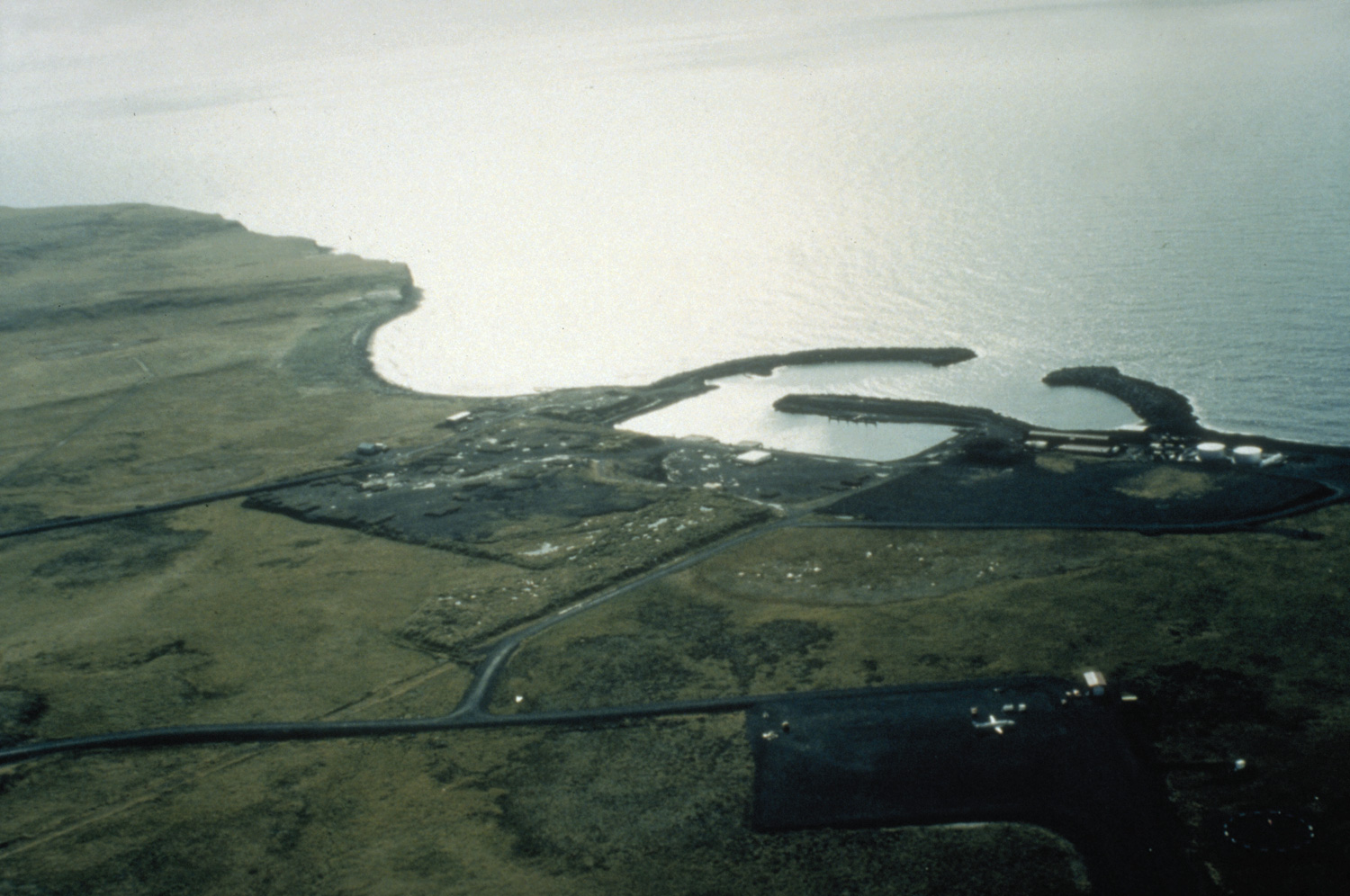
English: Aerial view of St. George, Alaska. |
|||
| Lieu | St. George Island, Alaska, USA | |||
| Dat | not specified or unknown | |||
| Sous |
U.S. Army Corps of Engineers Digital Visual Library Image page Image description page Digital Visual Library home page |
|||
| Kreyatè | U.S. Army Corps of Engineers, photographer not specified or unknown | |||
| Pèmisyon : (Resèvi ak fichye sa a) |
|
| Position de l'objet | | Voir cet endroit et d’autres images sur : OpenStreetMap |
|---|
Istorik fichye a
Klike sou yon dat/yon lè pou wè fichye a jan li te ye nan moman sa a.
| Dat ak lè | Minyati | Grandè yo | Itilizatè | Komantè | |
|---|---|---|---|---|---|
| Kounye a | 20 mas 2007 à 03:26 | | 1 500 × 996 (419 kio) | DanMS | {{Information | Description = Aerial view of St. George, Alaska. | Source = U.S. Army Corps of Engineers Digital Visual Library<br />[http://images.usace.army.mil/images/Hires/4414-25.Jpg Image page]<br />[http://images.usace.army.mil/scripts/P |
Itilizasyon fichye sa a
paj sa a itilize fichye sa a:
Itilizasyon global fichye a
Wiki sa a yo sèvi ak fichye sa a:
- Itilizasyon sou ar.wikipedia.org
- Itilizasyon sou arz.wikipedia.org
- Itilizasyon sou ast.wikipedia.org
- Itilizasyon sou azb.wikipedia.org
- Itilizasyon sou ca.wikipedia.org
- Itilizasyon sou ceb.wikipedia.org
- Itilizasyon sou ce.wikipedia.org
- Itilizasyon sou de.wikipedia.org
- Itilizasyon sou en.wikipedia.org
- Itilizasyon sou en.wikivoyage.org
- Itilizasyon sou es.wikipedia.org
- Itilizasyon sou eu.wikipedia.org
- Itilizasyon sou fa.wikipedia.org
- Itilizasyon sou fi.wikipedia.org
- Itilizasyon sou fr.wikipedia.org
- Itilizasyon sou it.wikipedia.org
- Itilizasyon sou ja.wikipedia.org
- Itilizasyon sou lld.wikipedia.org
- Itilizasyon sou mg.wikipedia.org
- Itilizasyon sou ml.wikipedia.org
- Itilizasyon sou nl.wikipedia.org
- Itilizasyon sou no.wikipedia.org
- Itilizasyon sou pl.wikipedia.org
- Itilizasyon sou ro.wikipedia.org
- Itilizasyon sou ru.wikipedia.org
- Itilizasyon sou sh.wikipedia.org
- Itilizasyon sou sq.wikipedia.org
- Itilizasyon sou sr.wikipedia.org
- Itilizasyon sou tly.wikipedia.org
- Itilizasyon sou tt.wikipedia.org
- Itilizasyon sou uk.wikipedia.org
- Itilizasyon sou ur.wikipedia.org
- Itilizasyon sou uz.wikipedia.org
- Itilizasyon sou www.wikidata.org