
Fichye:Pinal County Arizona Incorporated and Unincorporated areas Superior highlighted.svg

Taille de cet aperçu PNG pour ce fichier SVG : 800 × 600 piksèl. Lòt rezolisyon yo: 320 × 240 piksèl | 640 × 480 piksèl | 1 024 × 768 piksèl | 1 280 × 960 piksèl | 2 560 × 1 920 piksèl.
Fichye orijinal (Fichye SVG, rezolisyon de 800 × 600 piksèl, gwosè fichye : 152 kio)
Rezime
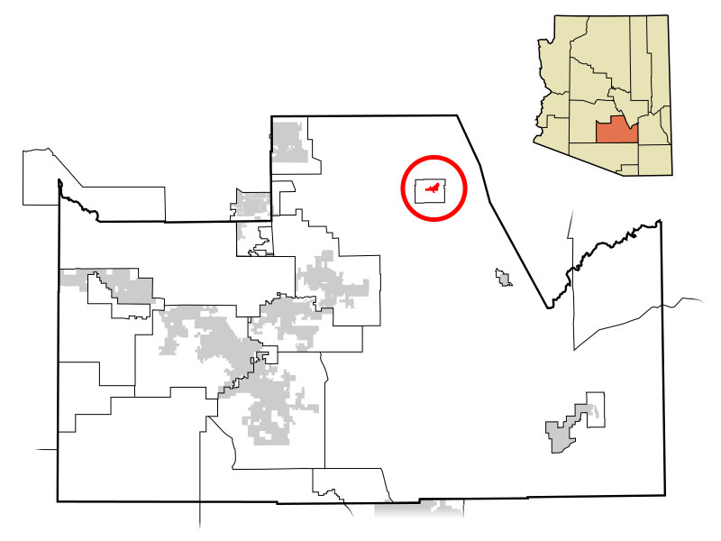
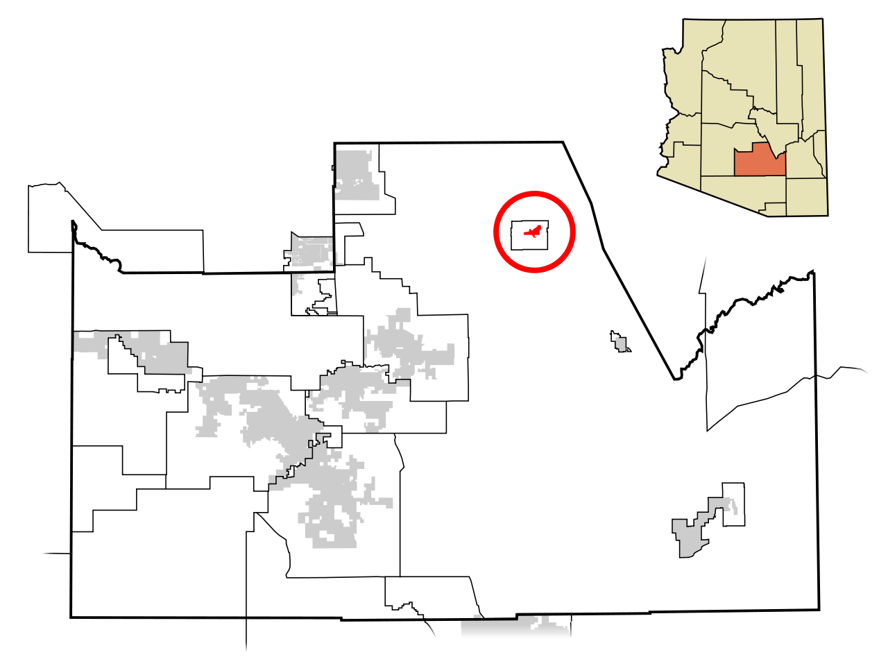
| Deskripsyon | This map shows the incorporated areas and unincorporated areas in Pinal County, Arizona. Superior is highlighted in red. Other incorporated cities are shown in gray, planning area borders for these cities and Indian reservation borders are shown as solid black lines. Map data is based on the following files as noted, all of which are .pdf files: *Pinal County 2008 Comprehensive Plan Amendments (.pdf) - For determining incorporated and Indian reservation boundaries. *CAAG Pinal Planning Commissioners Presentation (.pdf) - For determining planning area boundaries in Pinal County. *CAAG Population Estimates for Pinal County Places (.pdf) - For determining boundaries of unincorporated areas in Pinal County. Additional data for cities shown are based on individual files from each city's Website. (Please view the category page for links to these files.) I created this map in Inkscape. Please Note: This file replaces Image:Pinal County Incorporated areas Superior highlighted.svg, which is now obsolete! |
| Dat | |
| Sous | My own work, based on public domain information |
| Kreyatè | Ixnayonthetimmay |
| Pèmisyon : (Resèvi ak fichye sa a) |
Public Domain |
| Autres versions | See Category:Maps of Pinal County for other versions of this image. |
Kondisyon itlizasyon
| Moi, propriétaire des droits d’auteur sur cette œuvre, la place dans le domaine public. Ceci s'applique dans le monde entier. Dans certains pays, ceci peut ne pas être possible ; dans ce cas : J’accorde à toute personne le droit d’utiliser cette œuvre dans n’importe quel but, sans aucune condition, sauf celles requises par la loi. |
Istorik fichye a
Klike sou yon dat/yon lè pou wè fichye a jan li te ye nan moman sa a.
| Dat ak lè | Minyati | Grandè yo | Itilizatè | Komantè | |
|---|---|---|---|---|---|
| Kounye a | 8 jiyè 2009 à 05:44 | | 800 × 600 (152 kio) | Ixnayonthetimmay | == Summary == {{Information |Description=This map shows the incorporated areas and unincorporated areas in Pinal County, Arizona. [[:en:Gold Camp, Arizona|Gold |
| 19 avril 2008 à 17:56 |  | 800 × 600 (156 kio) | Ixnayonthetimmay | == Summary == {{Information |Description=This map shows the incorporated areas and unincorporated areas in Pinal County, Arizona. [[:en:Superior, Arizona|Superi |
Itilizasyon fichye sa a
paj sa a itilize fichye sa a:
Itilizasyon global fichye a
Wiki sa a yo sèvi ak fichye sa a:
- Itilizasyon sou ar.wikipedia.org
- Itilizasyon sou ca.wikipedia.org
- Itilizasyon sou cy.wikipedia.org
- Itilizasyon sou de.wikipedia.org
- Itilizasyon sou eu.wikipedia.org
- Itilizasyon sou fa.wikipedia.org
- Itilizasyon sou fr.wikipedia.org
- Itilizasyon sou it.wikipedia.org
- Itilizasyon sou pt.wikipedia.org
- Itilizasyon sou sr.wikipedia.org
- Itilizasyon sou tt.wikipedia.org
- Itilizasyon sou www.wikidata.org
- Itilizasyon sou zh-min-nan.wikipedia.org