
Fichye:Middletown CT river skyline.JPG
Dimansyon previzyalizasyon sa a : 800 × 450 piksèl. Lòt rezolisyon yo: 320 × 180 piksèl | 640 × 360 piksèl | 1 024 × 575 piksèl | 1 280 × 719 piksèl | 2 560 × 1 439 piksèl | 4 000 × 2 248 piksèl.
Fichye orijinal (4 000 × 2 248 piksèl, gwosè fichye a : 4,12 Mio, tip MIME li ye : image/jpeg)
Rezime
| Deskripsyon |
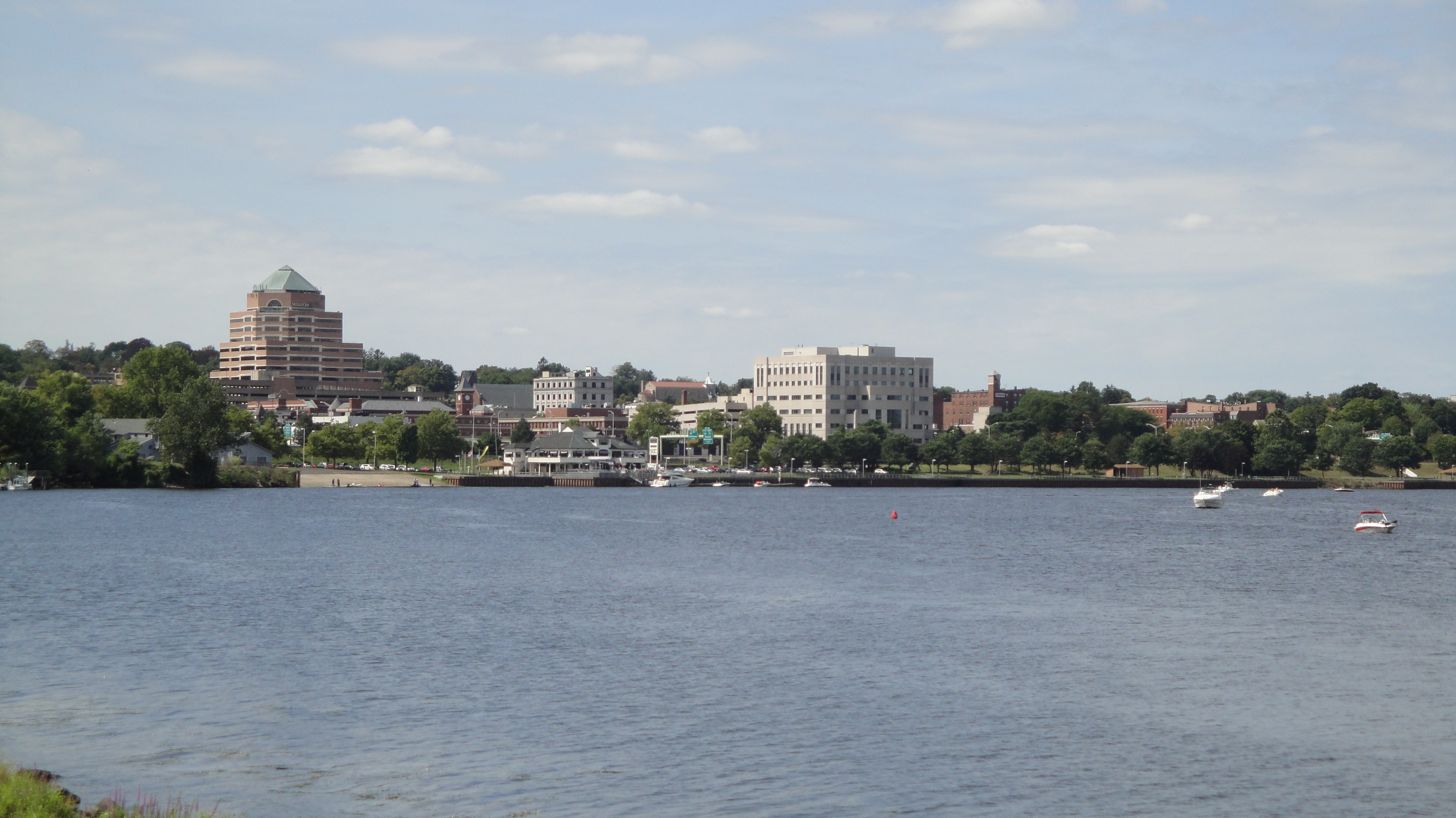
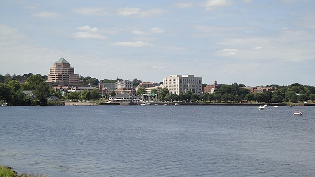
English: City of Middletown, Connecticut as seen from River Road, looking west/northwest along the major bend in the Connecticut River, showing Harbor Park and buildings along Main Street and downtown. |
| Dat | |
| Sous | Travay pèsonèl |
| Kreyatè | Bflood |
| Autres versions |
.JPG)
| Lieu de la prise de vue | | Voir cet endroit et d’autres images sur : OpenStreetMap |
|---|
Kondisyon itlizasyon
Moi, en tant que détenteur des droits d’auteur sur cette œuvre, je la publie sous la licence suivante :
Ce fichier est disponible selon les termes de la licence Creative Commons Attribution 3.0 Non transposée.
- Ou gen dwa:
- pou pataje – pou kopye, distribiye epi difize ouvraj la
- pou remiks – pou adapte ouvraj la
- Selon kondisyon sa a yo:
- Rekonèt avèk non otè – Ou dwe bay enfòmasyon apwopriye sou otè a, bay yon lyen pou lisans lan, epi endike si te gen chanjman ki fèt. Ou ka fè sa nan nenpòt fason rezonab, men okenn fason ki sijere ke otè a soutni oswa apwouve itilizasyon ou an.
Istorik fichye a
Klike sou yon dat/yon lè pou wè fichye a jan li te ye nan moman sa a.
| Dat ak lè | Minyati | Grandè yo | Itilizatè | Komantè | |
|---|---|---|---|---|---|
| Kounye a | 18 septanm 2009 à 16:15 | | 4 000 × 2 248 (4,12 Mio) | Bflood | {{Information |Description={{en|1=City of Middletown, Connecticut as seen from River Road, looking west/northwest along the major bend in the Connecticut River, showing Harbor Park and buildings along Main Street and downtown.}} |Source=Own work by upload |
Itilizasyon fichye sa a
paj sa a itilize fichye sa a:
Itilizasyon global fichye a
Wiki sa a yo sèvi ak fichye sa a:
- Itilizasyon sou ar.wikipedia.org
- Itilizasyon sou arz.wikipedia.org
- Itilizasyon sou azb.wikipedia.org
- Itilizasyon sou az.wikipedia.org
- Itilizasyon sou ca.wikipedia.org
- Itilizasyon sou ceb.wikipedia.org
- Itilizasyon sou ce.wikipedia.org
- Itilizasyon sou cy.wikipedia.org
- Itilizasyon sou de.wikipedia.org
- Itilizasyon sou en.wikipedia.org
- Itilizasyon sou en.wikivoyage.org
- Itilizasyon sou eu.wikipedia.org
- Itilizasyon sou fa.wikipedia.org
- Itilizasyon sou fr.wikipedia.org
- Itilizasyon sou fr.wikivoyage.org
- Itilizasyon sou gl.wikipedia.org
- Itilizasyon sou he.wikipedia.org
- Itilizasyon sou hu.wikipedia.org
- Itilizasyon sou id.wikipedia.org
- Itilizasyon sou ja.wikipedia.org
- Itilizasyon sou kk.wikipedia.org
- Itilizasyon sou ky.wikipedia.org
- Itilizasyon sou lld.wikipedia.org
- Itilizasyon sou no.wikipedia.org
- Itilizasyon sou pl.wikipedia.org
- Itilizasyon sou pt.wikipedia.org
- Itilizasyon sou ru.wikipedia.org
- Itilizasyon sou sr.wikipedia.org
- Itilizasyon sou sv.wikipedia.org
- Itilizasyon sou tl.wikipedia.org
- Itilizasyon sou tt.wikipedia.org
- Itilizasyon sou uk.wikipedia.org
- Itilizasyon sou ur.wikipedia.org
- Itilizasyon sou uz.wikipedia.org
- Itilizasyon sou vo.wikipedia.org
- Itilizasyon sou www.wikidata.org