
Fichye:Map of North Apollo, Armstrong County, Pennsylvania Highlighted.png

Fichye orijinal (1 502 × 2 106 piksèl, gwosè fichye a : 61 kio, tip MIME li ye : image/png)
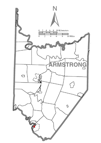
| Deskripsyon | A map of Armstrong County showing North Apollo, Pennsylvania (alternate) highlighted on the map. | |||
| Dat | ||||
| Sous | Source image taken from the United States Census Bureau's website pa_cosub.pdf. Image was modified by Ram-Man. | |||
| Kreyatè | (c)2006 Derek Ramsey (Ram-Man) (from U.S. Census Bureau source) | |||
| Pèmisyon : (Resèvi ak fichye sa a) |
A United States Census Bureau / Government work is in the public domain, however, my modifications are licensed as follows: You may NOT use this image on your own web site or anywhere else unless you release this image and any derivative works (e.g. your web site) by following the terms of one of the following licenses. Any other use will be considered a breach of copyright and I reserve the right of legal action. If you have not read the terms of these licenses or do not understand them, then do not use this image. Moi, en tant que détenteur des droits d’auteur sur cette œuvre, je la publie sous les licences suivantes :
Ce fichier est sous licence Creative Commons Attribution – Partage dans les Mêmes Conditions 2.5 Générique, 2.0 Générique et 1.0 Générique.
Chwazi lisans ou vle a. |
|||
| Autres versions | Image:Map of Armstrong County, Pennsylvania.png - Source map before highlighting. |

Istorik fichye a
Klike sou yon dat/yon lè pou wè fichye a jan li te ye nan moman sa a.
| Dat ak lè | Minyati | Grandè yo | Itilizatè | Komantè | |
|---|---|---|---|---|---|
| Kounye a | 8 oktòb 2006 à 00:58 | | 1 502 × 2 106 (61 kio) | Ram-Man | {{Information| |Description=Map of Armstrong County showing a location highlighted. |Source=Source image taken from the United States Census Bureau's website [http://www2.census.gov/geo/maps/general_ref/cousub_outli |
Itilizasyon fichye sa a
paj sa a itilize fichye sa a:
Itilizasyon global fichye a
Wiki sa a yo sèvi ak fichye sa a:
- Itilizasyon sou ar.wikipedia.org
- Itilizasyon sou ca.wikipedia.org
- Itilizasyon sou cy.wikipedia.org
- Itilizasyon sou eu.wikipedia.org
- Itilizasyon sou fr.wikipedia.org
- Itilizasyon sou it.wikipedia.org
- Itilizasyon sou sv.wikipedia.org
- Itilizasyon sou tt.wikipedia.org
- Itilizasyon sou vi.wikipedia.org
- Itilizasyon sou www.wikidata.org
- Itilizasyon sou zh-min-nan.wikipedia.org