
Fichye:Glendora, California (7134837923).jpg

Fichye orijinal (1 600 × 1 063 piksèl, gwosè fichye a : 666 kio, tip MIME li ye : image/jpeg)
.jpg)
Rezime
| Deskripsyon |
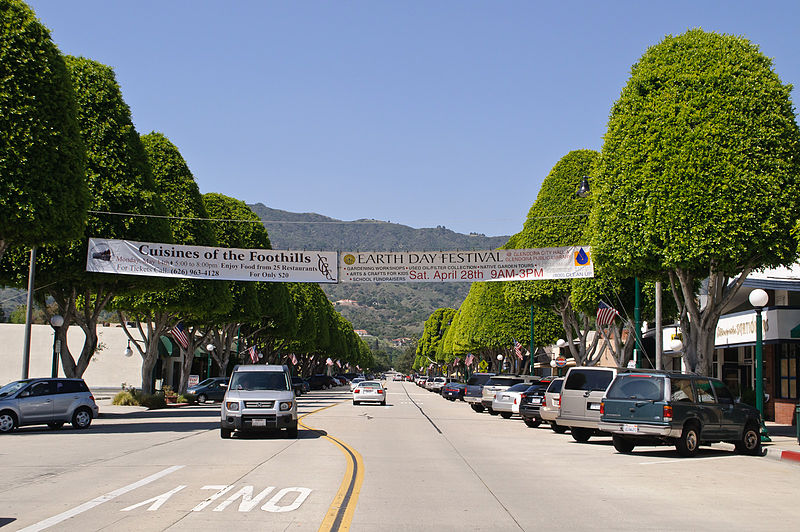
Looking north from Civic Center along Glendora Avenue, which is the historical shopping area that still is home to mom-and-pop stores. I am paying a visit to Glendora, located along the old Route 66 at the eastern edge of San Gabriel Valley, during its Earth Day festival. While San Gabriel Valley as a whole has gone through growth and demographic changes over the years, Glendora has retained the feel of San Gabriel Valley of yore; its population is smaller, its historic town core remains vibrant, and it is also a rare San Gabriel Valley city that remains majority white. My favorite singer-songwriter Anna Nalick grew up here in Glendora. And part of my Glendora visit is to soak up the same influences and vibes that had inspired Anna's songwriting. Following the vibes that have inspired my favorite musicians will now be a new twist to my future travels; in fact my Glendora visit is sort of a practice run for my visit to Huntington, Long Island, New York, just over a week later - where my longtime idol Mariah Carey grew up. |
| Dat | |
| Sous | Glendora, California |
| Kreyatè | InSapphoWeTrust from Los Angeles, California, USA |
| Lieu de la prise de vue | | Voir cet endroit et d’autres images sur : OpenStreetMap |
|---|
.jpg¶ms=034.135909_N_-117.865276_E_globe:Earth_type:camera_source:Flickr_&language=ht)
Kondisyon itlizasyon
- Ou gen dwa:
- pou pataje – pou kopye, distribiye epi difize ouvraj la
- pou remiks – pou adapte ouvraj la
- Selon kondisyon sa a yo:
- Rekonèt avèk non otè – Ou dwe bay enfòmasyon apwopriye sou otè a, bay yon lyen pou lisans lan, epi endike si te gen chanjman ki fèt. Ou ka fè sa nan nenpòt fason rezonab, men okenn fason ki sijere ke otè a soutni oswa apwouve itilizasyon ou an.
- Enfòmasyon sa yo ka pataje – Si ou fè rekopye, transfòme, oswa baze sou materyèl sa, ou dwe distribye kontribisyon ou anba menm oswa yon lisans konpatib avèk orijinal la.
| This image, originally posted to Flickr, was reviewed on 27 January 2013 by the administrator or reviewer File Upload Bot (Magnus Manske), who confirmed that it was available on Flickr under the stated license on that date. |
Istorik fichye a
Klike sou yon dat/yon lè pou wè fichye a jan li te ye nan moman sa a.
| Dat ak lè | Minyati | Grandè yo | Itilizatè | Komantè | |
|---|---|---|---|---|---|
| Kounye a | 27 janvye 2013 à 16:02 | | 1 600 × 1 063 (666 kio) | File Upload Bot (Magnus Manske) | Transferred from Flickr by User:russavia |
Itilizasyon fichye sa a
paj sa a itilize fichye sa a:
Itilizasyon global fichye a
Wiki sa a yo sèvi ak fichye sa a:
- Itilizasyon sou ar.wikipedia.org
- Itilizasyon sou arz.wikipedia.org
- Itilizasyon sou bg.wikipedia.org
- Itilizasyon sou ca.wikipedia.org
- Itilizasyon sou ceb.wikipedia.org
- Itilizasyon sou ce.wikipedia.org
- Itilizasyon sou eo.wikipedia.org
- Itilizasyon sou eu.wikipedia.org
- Itilizasyon sou fr.wikipedia.org
- Itilizasyon sou he.wikipedia.org
- Itilizasyon sou hu.wikipedia.org
- Itilizasyon sou hy.wikipedia.org
- Itilizasyon sou it.wikipedia.org
- Itilizasyon sou lld.wikipedia.org
- Itilizasyon sou no.wikipedia.org
- Itilizasyon sou pl.wikipedia.org
- Itilizasyon sou pt.wikipedia.org
- Itilizasyon sou ru.wikipedia.org
- Itilizasyon sou sr.wikipedia.org
- Itilizasyon sou tr.wikipedia.org
- Itilizasyon sou tt.wikipedia.org
- Itilizasyon sou uz.wikipedia.org
- Itilizasyon sou vo.wikipedia.org
- Itilizasyon sou www.wikidata.org
- Itilizasyon sou zh-min-nan.wikipedia.org
.jpg)