
Fichye:Descent of Phoenix with a crater in the background taken by Mars Reconnaissance Orbiter.jpg
Fichye orijinal (1 500 × 746 piksèl, gwosè fichye a : 686 kio, tip MIME li ye : image/jpeg)
Rezime
| Deskripsyon |
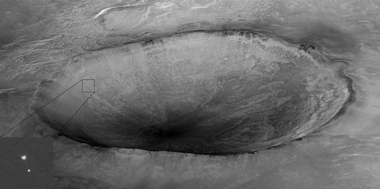
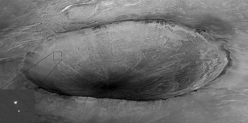
English: Image taken by Mars Reconnaissance Orbiter showing descent of Phoenix with a crater in the background. Original caption from NASA: Español: Imagen tomada por Mars Reconnaissance Orbiter (MRO) que muestra el descenso de la sonda espacial Phoenix y un cráter marciano al fondo. La sonda Phoenix y su paracaídas, que acaba de abrirse, descienden hacia la superficie marciana. Al fondo hay un cráter de 10 km llamado "Heimdall". Aunque parece descender hacia el interior del cráter, la sonda está en realidad 20 kilómetros más cerca a una altitud de 13 km.
Esta imagen fue tomada por la cámara HiRISE de la sonda MRO. En el momento de la toma, MRO se encontraba a 760 km de Phoenix, a una altitud de 310 km, y viajaba a una velocidad de 3,4 km/s. El proyecto Phoenix está dirigido por la Universidad de Arizona y administrado por el Laboratorio de Propulsión a Reacción. La nave espacial fue desarrollada por Lockheed Martin Space Systems. Français : Image prise par la sonde spatiale MRO montrant la descente de la sonde Phoenix et un cratère en arrière plan.
La sonde Phoenix et son parachute qui vient de s'ouvrir descendent vers la surface martienne. En arrière plan se trouve un cratère de 10 km nommé "Heimdall". Bien qu'elle semble descendre vers l'intérieur du cratère, la sonde est en réalité 20 kilomètres plus proche, et a une altitude de 13 km. Українська: Зображення, зроблене Mars Reconnaissance Orbiter, яке показує спуск Фенікса з кратером Марсу, на задньому плані. |
| Dat | |
| Sous | http://photojournal.jpl.nasa.gov/catalog/PIA10705 |
| Kreyatè | NASA/Jet Propulsion Lab-Caltech/University of Arizona |
| Pèmisyon : (Resèvi ak fichye sa a) |
PD-USGOV-NASA |
| Autres versions | File:Phoenix descent — unannotated.jpg |
Distinctions
|
Cette image a été choisie comme image du jour pour le 18 décembre 2021. La description associée était la suivante : Français : Image prise par la sonde spatiale MRO montrant la descente de la sonde Phoenix et un cratère en arrière plan. Autres langues :
Čeština: Snímek pořízený planetární sondou Mars Reconnaissance Orbiter ukazující sestupující sondu Phoenix s kráterem na povrchu Marsu v pozadí. English: Image taken by Mars Reconnaissance Orbiter showing descent of Phoenix with a crater in the background. Español: Imagen tomada por Mars Reconnaissance Orbiter que muestra el descenso de la sonda espacial Phoenix y un cráter marciano al fondo. Français : Image prise par la sonde spatiale MRO montrant la descente de la sonde Phoenix et un cratère en arrière plan. Italiano: Immagine ripresa dal Mars Reconnaissance Orbiter che mostra la discesa della sonda Phoenix con un cratere di Marte sullo sfondo. Magyar: A Mars Reconnaissance Orbiter felvétele a Phoenix űrszonda leszállásáról, a háttérben egy kráterrel Nederlands: Afdaling van de sonde Phoenix naar het oppervlak van Mars. Foto gemaakt dor de Mars Reconnaissance Orbiter. Português: Imagem tirada pela sonda espacial Mars Reconnaissance Orbiter mostrando a descida da Phoenix com uma cratera de Marte ao fundo. Русский: Фотография АМС «Феникс», спускающейся на парашюте в атмосфере Марса, сделанная Mars Reconnaissance Orbiter Українська: Зображення, зроблене Mars Reconnaissance Orbiter, яке показує спуск Фенікса з марсіанським кратером «Геймдаль», на задньому плані. |
Cette image ou vidéo a été cataloguée par le Jet Propulsion Lab de la National Aeronautics and Space Administration (NASA) des États-Unis sous Photo ID : PIA10705.Ce bandeau n’indique rien sur le statut de l’œuvre au regard du droit d'auteur. Un bandeau de droit d’auteur est requis. Voir Commons:À propos des licences pour plus d’informations. Autres langues :
|
| Ce fichier provient de la NASA. Sauf exception, les documents créés par la NASA ne sont pas soumis à copyright. Pour plus d'informations, voir la politique de copyright de la NASA. | ||
 |
Attention :
|
Journal des téléversements d’origine
| date/time | username | resolution | size | edit summary | |
|---|---|---|---|---|---|
| 22:32, 27 May 2008 | User:BloodIce | <a href="http://upload.wikimedia.org/wikipedia/commons/8/85/PIA10705.jpg"><img alt="Thumbnail for version as of 22:32, 27 May 2008" src="http://upload.wikimedia.org/wikipedia/commons/thumb/8/85/PIA10705.jpg/120px-PIA10705.jpg" width="120" height="60" border="0" /></a> | 1,500×746 | 181 KB | {{Information |Description= Image taken by <a href="http://en.wikipedia.org/wiki/Mars_Reconnaissance_Orbiter" class="extiw" title="en:Mars Reconnaissance Orbiter">Mars Reconnaissance Orbiter</a> showing <a href="http://en.wikipedia.org/wiki/Phoenix_(spacecraft)" class="extiw" title="en:Phoenix (spacecraft)">Phoenix</a> descending with crater in the background. |Source=[http://photojournal.jpl.nasa.gov/spacecraft/MRO Jet |
Istorik fichye a
Klike sou yon dat/yon lè pou wè fichye a jan li te ye nan moman sa a.
| Dat ak lè | Minyati | Grandè yo | Itilizatè | Komantè | |
|---|---|---|---|---|---|
| Kounye a | 7 janvye 2019 à 17:20 | | 1 500 × 746 (686 kio) | Kesäperuna | 100% JPEG quality from full quality TIFF. |
| 25 desanm 2008 à 07:16 |  | 1 500 × 746 (181 kio) | BetacommandBot | move approved by: User:LERK This image was moved from File:PIA10705.jpg {{Featured picture}} == Summary == {{Information |Description= {{en|Image taken by Mars Reconnaissance Orbiter showing descent of [[:en: |
Itilizasyon fichye sa a
2 paj sa yo itilize fichye sa a:
Itilizasyon global fichye a
Wiki sa a yo sèvi ak fichye sa a:
- Itilizasyon sou af.wikipedia.org
- Itilizasyon sou alt.wikipedia.org
- Itilizasyon sou av.wikipedia.org
- Itilizasyon sou bg.wikipedia.org
- Itilizasyon sou crh.wikipedia.org
- Itilizasyon sou cv.wikipedia.org
- Itilizasyon sou da.wikipedia.org
- Itilizasyon sou de.wikipedia.org
- Itilizasyon sou de.wiktionary.org
- Itilizasyon sou en.wikipedia.org
- Itilizasyon sou et.wikipedia.org
- Itilizasyon sou fa.wikipedia.org
- Itilizasyon sou fr.wikipedia.org
- Itilizasyon sou hu.wikipedia.org
- Itilizasyon sou hy.wikipedia.org
- Itilizasyon sou it.wikipedia.org
- Itilizasyon sou ja.wikipedia.org
- Itilizasyon sou jv.wikipedia.org
- Itilizasyon sou ka.wikipedia.org
- Itilizasyon sou kk.wikipedia.org
- Itilizasyon sou ko.wikipedia.org
- Itilizasyon sou lbe.wikipedia.org
- Itilizasyon sou lez.wikipedia.org
- Itilizasyon sou mk.wikipedia.org
- Itilizasyon sou ms.wikipedia.org
Gade plis itilizasyon global fichye sa a.