
Fichye:Benin sat.png

Dimansyon previzyalizasyon sa a : 299 × 600 piksèl. Lòt rezolisyon yo: 119 × 240 piksèl | 371 × 744 piksèl.
Fichye orijinal (371 × 744 piksèl, gwosè fichye a : 378 kio, tip MIME li ye : image/png)
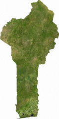
ECW to TIFF to PNG (compression level 9).
| This file is in the public domain, because it was generated by a user, using free sources available at The Map Library.
Note that this does not include the maps in the Global Administrative Areas section of the homepage. |
Istorik fichye a
Klike sou yon dat/yon lè pou wè fichye a jan li te ye nan moman sa a.
| Dat ak lè | Minyati | Grandè yo | Itilizatè | Komantè | |
|---|---|---|---|---|---|
| Kounye a | 13 jiyè 2006 à 02:45 | | 371 × 744 (378 kio) | Unquietwiki | ECW to TIFF to PNG (compression level 9). {{PD-MapLibrary}} |
Itilizasyon fichye sa a
Pa gen okenn paj ki itilize dosye sa a.
Itilizasyon global fichye a
Wiki sa a yo sèvi ak fichye sa a:
- Itilizasyon sou af.wikipedia.org
- Itilizasyon sou ceb.wikipedia.org
- Itilizasyon sou fa.wikipedia.org
- Itilizasyon sou fi.wikipedia.org
- Itilizasyon sou it.wikipedia.org
- Itilizasyon sou pt.wikipedia.org
- Itilizasyon sou uk.wikipedia.org
- Itilizasyon sou vec.wikipedia.org
- Itilizasyon sou vi.wikipedia.org
- Itilizasyon sou wo.wikipedia.org