
Fichye:Accreting coast Image6.svg

Taille de cet aperçu PNG pour ce fichier SVG : 800 × 377 piksèl. Lòt rezolisyon yo: 320 × 151 piksèl | 640 × 301 piksèl | 1 024 × 482 piksèl | 1 280 × 602 piksèl | 2 560 × 1 205 piksèl | 1 481 × 697 piksèl.
Fichye orijinal (Fichye SVG, rezolisyon de 1 481 × 697 piksèl, gwosè fichye : 15 kio)
Rezime
| Deskripsyon |
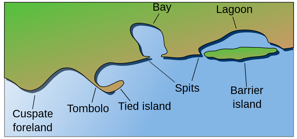
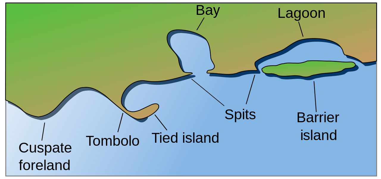
English: Coastal and oceanic landforms. Cuspate foreland, tombolo, spit, bay, lagoon, barrier island. |
| Dat | |
| Sous | self-made SVG, based on the public domain PNG Accreting coast Image6.png by Feydey |
| Kreyatè | Surachit |
| Autres versions |
Œuvres dérivées de ce fichier : Accreting coast Image6-ta.svg
|
| SVG information |


Kondisyon itlizasyon
| Cette œuvre a été placée dans le domaine public par son auteur, Feydey. Ceci s’applique dans le monde entier. Dans certains pays, ceci peut ne pas être possible ; dans ce cas : |
Istorik fichye a
Klike sou yon dat/yon lè pou wè fichye a jan li te ye nan moman sa a.
| Dat ak lè | Minyati | Grandè yo | Itilizatè | Komantè | |
|---|---|---|---|---|---|
| Kounye a | 16 me 2022 à 04:17 | | 1 481 × 697 (15 kio) | Bacon Noodles | Fixed background (water) alignment |
| 12 fevriye 2018 à 01:49 |  | 1 481 × 697 (15 kio) | Howpper | Added tied island. A Tombolo is what connects a Tied island to the mainland, so it would be exclusive to not include both features. | |
| 16 out 2007 à 21:48 |  | 1 481 × 697 (13 kio) | Surachit | {{Information |Description=Coastal and oceanic landforms. Cuspate foreland, tombolo, spit, bay, lagoon, barrier island. |Source=self-made SVG, based on the public domain PNG [http://en.wikipedia.org/wiki/Image:Accreting_coast_Image6.png] by [http://en.wik |
Itilizasyon fichye sa a
paj sa a itilize fichye sa a:
Itilizasyon global fichye a
Wiki sa a yo sèvi ak fichye sa a:
- Itilizasyon sou ar.wikipedia.org
- Itilizasyon sou az.wikipedia.org
- Itilizasyon sou bh.wikipedia.org
- Itilizasyon sou chr.wikipedia.org
- Itilizasyon sou cs.wikipedia.org
- Itilizasyon sou en.wikipedia.org
- Archipelago
- Coast
- Dune
- Island
- List of peninsulas
- Beach
- Fjord
- Atoll
- Strait
- Boulder
- Estuary
- Natural arch
- Lagoon
- Coral reef
- Firth
- Isthmus
- Gulf of California
- Coastal erosion
- Talk:Beach
- River delta
- Cliff
- Reef
- Islet
- Salt marsh
- Tombolo
- Stack (geology)
- Cove
- Shoal
- Spit (landform)
- Longshore drift
- Ria
- Barrier island
- Emergent coastline
- Submergent coastline
- Groyne
- Rip current
- Pebble
- Discordant coastline
- Wave-cut platform
Gade plis itilizasyon global fichye sa a.