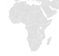
Fichye:BlankMap-Africa.png
Apparence
BlankMap-Africa.png (341 × 341 piksèl, gwosè fichye a : 8 kio, tip MIME li ye : image/png)
Istorik fichye a
Klike sou yon dat/yon lè pou wè fichye a jan li te ye nan moman sa a.
| Dat ak lè | Minyati | Grandè yo | Itilizatè | Komantè | |
|---|---|---|---|---|---|
| Kounye a | 8 mas 2018 à 12:01 |  | 341 × 341 (8 kio) | Maphobbyist | South Sudan border |
| 29 mas 2016 à 17:56 |  | 380 × 360 (8 kio) | Fry1989 | Reverted to version as of 22:40, 26 December 2014 (UTC) | |
| 27 mas 2016 à 20:29 |  | 341 × 341 (3 kio) | Rockthe | Reverted to version as of 16:47, 3 April 2005 (UTC) | |
| 26 desanm 2014 à 22:40 |  | 380 × 360 (8 kio) | Middayexpress | fix legal border | |
| 7 avril 2012 à 06:28 |  | 380 × 360 (11 kio) | Spesh531 | Libyan civil war long over, adjusted azawad border +minor fixes | |
| 7 avril 2012 à 02:18 |  | 380 × 360 (12 kio) | Phoenix B 1of3 | Azawad | |
| 11 jiyè 2011 à 22:23 |  | 380 × 360 (8 kio) | Spesh531 | back to the newer version,YOU COULD HAVE JUST EDITED THE OTHER VERSION. | |
| 9 jiyè 2011 à 19:11 |  | 341 × 341 (9 kio) | Maphobbyist | South Sudan has become independent on July 9, 2011. Sudan and South Sudan are shown with the new international border between them. | |
| 2 mas 2011 à 01:57 |  | 351 × 341 (11 kio) | Spesh531 | With new standards and South Sudan, and unrecognized countries | |
| 20 fevriye 2007 à 17:03 |  | 341 × 341 (3 kio) | ፈቃደ | Reverted to earlier revision |
Itilizasyon fichye sa a
2 paj sa yo itilize fichye sa a:
Itilizasyon global fichye a
Wiki sa a yo sèvi ak fichye sa a:
- Itilizasyon sou af.wikipedia.org
- Itilizasyon sou am.wikipedia.org
- Itilizasyon sou ar.wikipedia.org
- Itilizasyon sou da.wikipedia.org
- Itilizasyon sou en.wikipedia.org
- Itilizasyon sou es.wikipedia.org
- Usuario Discusión:Dark512
- Usuario:Dark512
- Usuario:Suomi 1973
- Usuario:Userbox/Wikiproyectos
- Usuario:Millars
- Wikiproyecto:África
- Wikiproyecto:África/Userbox
- Usuario:Userbox/Localización/África
- Usuario:Tlalcomulco
- Usuario:Jomiabe
- Usuario:Julioms64
- Usuario:Santi92/Userboxes
- Usuario:Lanke Llion
- Usuario:MucosoPucoso
- Usuario:74MMOTPH
- Usuario:Xatanga
- Usuario:Jafol
- Usuaria:Meltryth
- Usuaria:Userbox mujer/Wikiproyectos
- Usuaria:Userbox mujer/Localización/África
- Usuario:Assacen
- Usuario:Planeta de Cor-Azul
- Usuario:Planeta de Cor-Azul/PU
- Usuario:ARGFutbolero
- Itilizasyon sou fr.wikipedia.org
- Itilizasyon sou hu.wikipedia.org
- Itilizasyon sou hy.wikipedia.org
- Itilizasyon sou id.wikipedia.org
- Itilizasyon sou incubator.wikimedia.org
- Itilizasyon sou ko.wikipedia.org
- Itilizasyon sou lv.wikipedia.org
- Itilizasyon sou new.wikipedia.org
Gade plis itilizasyon global fichye sa a.


