
Fichye:Phoenix mission landing.jpg

Dimansyon previzyalizasyon sa a : 600 × 600 piksèl. Lòt rezolisyon yo: 240 × 240 piksèl | 480 × 480 piksèl | 768 × 768 piksèl | 1 024 × 1 024 piksèl.
Fichye orijinal (1 024 × 1 024 piksèl, gwosè fichye a : 132 kio, tip MIME li ye : image/jpeg)
Rezime
| Deskripsyon |
English: Original description:
|
| Sous | Official mission gallery (Image). Transféré de en.wikipedia à Commons. |
| Kreyatè |
Kondisyon itlizasyon
| Ce fichier provient de la NASA. Sauf exception, les documents créés par la NASA ne sont pas soumis à copyright. Pour plus d'informations, voir la politique de copyright de la NASA. | ||
 |
Attention :
|
Journal des téléversements d’origine
La page de description originale était ici. Tous les noms d'utilisateur qui suivent se rapportent à en.wikipedia.
- 2008-05-26 02:27 Noclip 1024×1024×8 (134990 bytes)
Istorik fichye a
Klike sou yon dat/yon lè pou wè fichye a jan li te ye nan moman sa a.
| Dat ak lè | Minyati | Grandè yo | Itilizatè | Komantè | |
|---|---|---|---|---|---|
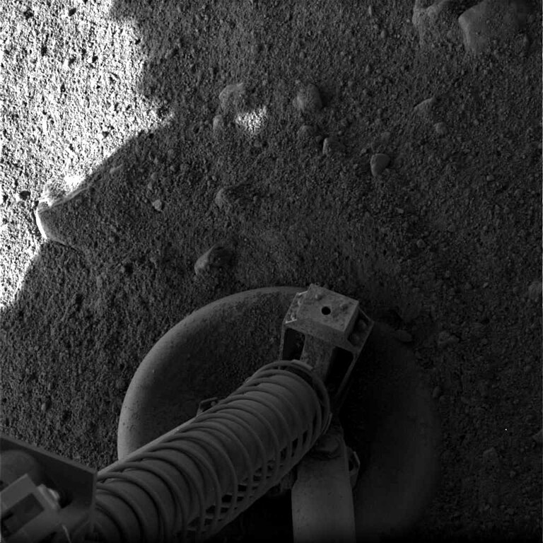
| Kounye a | 26 me 2008 à 06:22 | | 1 024 × 1 024 (132 kio) | Mattflaschen | {{Information |Description={{en|The surface underneath the Phoenix lander, taken minutes after landing.}} |Source=Transferred from [http://en.wikipedia.org en.wikipedia] |Date=2008-05-26 (original upload date) |Author=Original up |
Itilizasyon fichye sa a
2 paj sa yo itilize fichye sa a:
Itilizasyon global fichye a
Wiki sa a yo sèvi ak fichye sa a:
- Itilizasyon sou be.wikipedia.org
- Itilizasyon sou bg.wikipedia.org
- Itilizasyon sou de.wikipedia.org
- Itilizasyon sou en.wikipedia.org
- Itilizasyon sou eo.wikipedia.org
- Itilizasyon sou es.wikinews.org
- Itilizasyon sou he.wikipedia.org
- Itilizasyon sou it.wikipedia.org
- Itilizasyon sou kk.wikipedia.org
- Itilizasyon sou ko.wikipedia.org
- Itilizasyon sou lv.wikipedia.org
- Itilizasyon sou pt.wikipedia.org
- Itilizasyon sou sl.wikipedia.org
- Itilizasyon sou tr.wikipedia.org
- Itilizasyon sou uk.wikipedia.org
- Itilizasyon sou zh.wikipedia.org