
Fichye:Dominican Republic location map.svg

Taille de cet aperçu PNG pour ce fichier SVG : 737 × 600 piksèl. Lòt rezolisyon yo: 295 × 240 piksèl | 590 × 480 piksèl | 944 × 768 piksèl | 1 259 × 1 024 piksèl | 2 517 × 2 048 piksèl | 1 400 × 1 139 piksèl.
Fichye orijinal (Fichye SVG, rezolisyon de 1 400 × 1 139 piksèl, gwosè fichye : 182 kio)
queretaro
Rezime
| Deskripsyon |
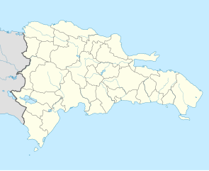
Deutsch: Positionskarte Dominikanische Republik mit Provinzen, Quadratische Plattkarte, N-S-Streckung 105 %. Geographische Begrenzung der Karte:
English: Location map Dominican Republic with Provinces, Equirectangular projection, N/S stretching 105 %. Geographic limits of the map:
|
||
| Dat | |||
| Sous |
Travay pèsonèl,VMAP0, http://www.one.gob.do, http://lib.utexas.edu/maps/dominican_republic.html
|
||
| Kreyatè | Alexrk2 | ||
| Autres versions |
|
||
| SVG information |
|


Kondisyon itlizasyon
Moi, en tant que détenteur des droits d’auteur sur cette œuvre, je la publie sous la licence suivante :
Fichye sa a distribiye selon lisans Creative Commons.
- Ou gen dwa:
- pou pataje – pou kopye, distribiye epi difize ouvraj la
- pou remiks – pou adapte ouvraj la
- Selon kondisyon sa a yo:
- Rekonèt avèk non otè – Ou dwe bay enfòmasyon apwopriye sou otè a, bay yon lyen pou lisans lan, epi endike si te gen chanjman ki fèt. Ou ka fè sa nan nenpòt fason rezonab, men okenn fason ki sijere ke otè a soutni oswa apwouve itilizasyon ou an.
- Enfòmasyon sa yo ka pataje – Si ou fè rekopye, transfòme, oswa baze sou materyèl sa, ou dwe distribye kontribisyon ou anba menm oswa yon lisans konpatib avèk orijinal la.
Istorik fichye a
Klike sou yon dat/yon lè pou wè fichye a jan li te ye nan moman sa a.
| Dat ak lè | Minyati | Grandè yo | Itilizatè | Komantè | |
|---|---|---|---|---|---|
| Kounye a | 10 fevriye 2010 à 18:39 | | 1 400 × 1 139 (182 kio) | Alexrk2 | fixed boundary style |
| 7 fevriye 2010 à 13:17 |  | 1 400 × 1 139 (181 kio) | Alexrk2 | == Summary == {{Information |Description= {{de|Positionskarte Dominikanische Republik mit Provinzen, Quadratische Plattkarte, N-S-Streckung 105 %. Geographische Begrenzung der Karte:}} {{en|Location map [[:en:Dominican Repu |
Itilizasyon fichye sa a
paj sa a itilize fichye sa a:
Itilizasyon global fichye a
Wiki sa a yo sèvi ak fichye sa a:
- Itilizasyon sou af.wikipedia.org
- Itilizasyon sou an.wikipedia.org
- Itilizasyon sou ar.wikipedia.org
- Itilizasyon sou ast.wikipedia.org
- La Barraquera (San José de Ocoa)
- Oviedo (República Dominicana)
- Santu Domingu
- Módulu:Mapa de llocalización/datos/República Dominicana
- Bancu Central de la República Dominicana
- Módulu:Mapa de llocalización/datos/República Dominicana/usu
- Copa Panamericana de Voleibol Femenín de 2018
- Aeródromu de Cabo Rojo
- Aeropuertu Domésticu de Constanza
- Aeropuertu Osvaldo Virgil
- Aeródromu de Portillo
- Puertu de Puerto Plata
- Puertu de San Pedro de Macorís
- Puertu de Santu Domingu
- Ríu Ozama
- Itilizasyon sou az.wikipedia.org
- Itilizasyon sou ba.wikipedia.org
- Itilizasyon sou be-tarask.wikipedia.org
- Itilizasyon sou be.wikipedia.org
- Itilizasyon sou bg.wikipedia.org
- Itilizasyon sou bn.wikipedia.org
- Itilizasyon sou bs.wikipedia.org
- Itilizasyon sou ca.wikipedia.org
- Itilizasyon sou ceb.wikipedia.org
Gade plis itilizasyon global fichye sa a.